Colorado’s snowpack levels continue to surpass previous years, with the most recent rise being driven by an intensive sequence of winter storms that brought multiple feet of additional snow to the High Country.
Snowpack, also known as snow-water equivalent, is a measure of how much liquid water is stored in the state’s snowfields. The amount of snowpack that Colorado accumulates this winter will have a significant impact on drought conditions, stream flow, and the health of the state’s reservoirs.
As of Friday, November 29, statewide snowpack levels had reached 134% of the 30-year median, according to Natural Resources Conservation Service statistics. It is the highest level seen this time of year in the last ten years.
The Arkansas River Basin, which extends from north of Colorado Springs to the New Mexico border, has roughly 200% of its typical snowfall as of Friday.
The central-mountain Colorado Headwaters River basin was at 134%, while the Yampa-White-Little Snake River Basin, which includes Steamboat Springs, was at 103%. Snowpack levels usually peak in April, but the dates vary by basin.
“We’re off to a great start, especially with the storm that just came through,” National Weather Service meteorologist Zach Hiris stated. “We’ve got plenty of time to build up the snowpack, it’s just a matter of what the second half of the winter looks like in terms of how we end the season.”
Back-to-back storms late last week and into Wednesday helped ski areas open acres of new terrain, with Copper Mountain becoming Colorado’s first resort to receive 100 inches of snow this season.

The powder craze, however, will come to an end, with no additional snow expected for at least the next week.
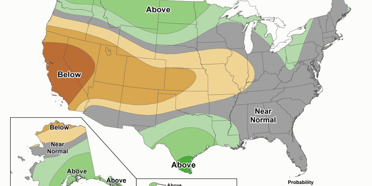
According to the Climate Prediction Center’s 6- to 10-day forecast, there is a higher likelihood that the state’s mountains will receive less rain than usual. The month-long forecast for December indicates similar possibilities of above- or below-normal precipitation, with a slightly higher likelihood of above-normal temperatures.
“The forecast is bleak in terms of much-needed precipitation,” National Weather Service meteorologist Robert Koopmeiners stated. “There’s a slow warming trend, and it is just bone dry.”
Forecasts indicate that the next greatest possibility of snow for the state’s mountains may not come until the second week of December, with warm temperatures that may rise above normal, but daytime highs in mountain valley areas may remain in the 30s.
In a Friday blog post, OpenSnow.com founder meteorologist Joel Gratz forecasted that the state’s rapidly rising snowpack line will flatten and hold close to normal.
“Our snowpack will be okay since the sun angle is low and temperatures will be cool,” according to Gratz.
The next likelihood of snowfall is around December 9 or 10, though Gratz says there is only a 20% to 30% chance right now. Greater confidence is growing that a storm will hit before the end of the week, around December 13 or 14.
Weather models “depict a change in the overall storm track with colder air and storm energy beginning to track into the Rockies and potentially back to the West Coast,” according to Gratz.
“With this trend in the models, I’m relatively optimistic that we’ll have more snow to talk about starting in mid-December, though a two-week forecast is only useful for spotting trends and not forecasting weather on specific days.”
